|
|
|||
|
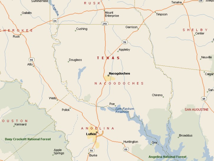
NACOGDOCHES AREA MAP |
|||
|
The population of Nacogdoches was 29,914 at the time of the 2000 census. Nacogdoches is about 140 miles northeast of Houston, 90 miles southwest of Shreveport, Louisiana and 180 miles southwest of Dallas. The city center of Nacogdoches is located immediately
north of the fork of LaNana and Banita Creeks. Lake Nacogdoches is
about 10 miles west of town. |
|
||
|
|
|||
|
The first oil well in Texas was in Nacogdoches. But it was no gusher, only producing about 10 barrels a day. Cotton, tobacco and logging fueled the economy of Nacogdoches into the 20th century. In 2010 Nacogdoches' primary economic assets are tourism and Stephen F. Austin State University with its 12,000 students. |
|||
|
|
|||
|
|||
|
|
|||
|
Visit
our Eyes on Texas Blog to make a comment or share info about Nacogdoches |
|||
|
|
|||
|
|
|||
| HOME TEXAS TOWNS PARADES | |||
|
|
|||
| BIG BEND COUNTRY | |||
| GULF COAST PINEY WOODS | |||
| PRAIRIE & LAKES HILL COUNTRY | |||
| SOUTH TEXAS PLAINS | |||
| PANHANDLE PLAINS | |||
|
|
|||
| Conroe Huntsville Jefferson | |||
| Nacogdoches Marshall Gilmer | |||
| Rusk Tyler Kilgore | |||
| Big Thicket National Preserve | |||