|
|
|||
|
Mount Rainier |
|||
|
|
|||
|
|||
|
The photos below
of |
|||
|
|
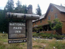
Ā Āclick thumbnails to enlargeĀ The National Park Inn at Longmire. This is a large complex of buildings in addition to the Inn. Among them are the Wilderness Information Center. There is Longmire Museum where you can ask a ranger a question and see a cougar. Cougar Rock Campground is about 2 miles northwest of Longmire. Longmire is the location of one of the starting points of the Wonderland Trail. |
||
|
|
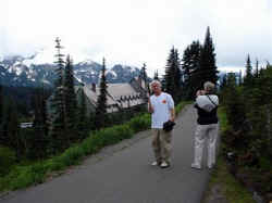
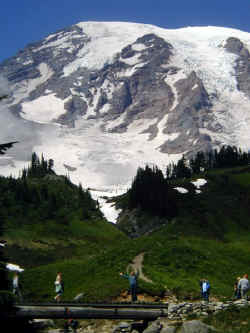
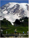
It can be difficult to find parking at Paradise. Paradise is the main destination of Mount Rainier National Park visitors. It is from here you can easily hike to the mountain. Or stay in the Paradise Inn. That is the Paradise Inn you see in the background. Paradise is also the location of the Henry M. Jackson Visitor Center. | ||
|
|
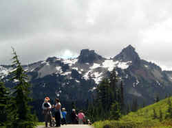
Looking south at some of the mountains Mount Rainier looks down on. In Mount Rainier National Park there are valleys, wildflower meadows, forest of old growth evergreens and waterfalls. | ||
|
|
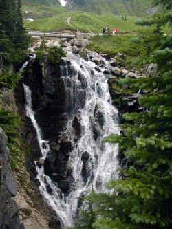
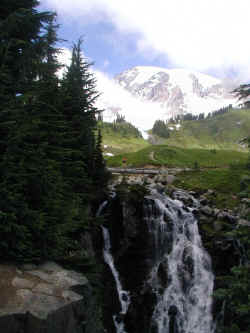
That cascading water is called Myrtle Falls. You can see some people crossing a wooden bridge above the falls, heading towards trails through the meadows that lead up to the base of Mount Rainier. | ||
|
click
here to view video of our |
|||
|
|
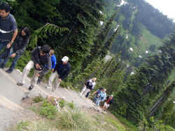
Hikers making their way back up the steps from the Myrtle Falls overlook. | ||
|
|
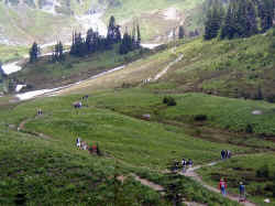
The meadows and trails that lead up to the base of Mount Rainier. | ||
|
|
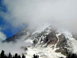
Mount Rainier was not visible when we arrived. But The Mountain slowly revealed itself as the day progressed. | ||
|
|
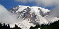
The Mountain is almost free of clouds. More than 10,000 people attempt to reach the summit of Mount Rainier each year. Lately there has been a fad of speed climbing with many making the up to the top and back down to Paradise trek. The current record is held by Liam O'Sullivan who managed the round-trip climb on August 4, seven days before this photo was taken, in four hours, 46 minutes and 29 seconds. |
||
|
|
A clear look at The Mountain, the clouds all gone. The National Park Service claims that Paradise is the "snowiest place on Earth." Others claim that title is held by another Washington volcano, Mount Baker. 1,122 inches of snow fell the winter of 1971-72, setting a world record that year. | ||
|
|
Back at the Myrtle Falls overlook again for another photo now that Mount Rainier has chosen to reveal itself. | ||
|
|
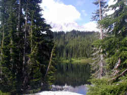
We came into the park from the west, at the Nisqually Entrance. We drove the loop to exit from the north. On the way we came to Mirror Lake. This is the scene on many a postcard and calendar. Not quite the scene you see here, due to Mount Rainier being a little shrouded by clouds again and access to good viewing points being blocked by snow. In August. | ||
|
|
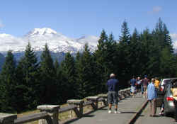
Further down the road we came to a viewpoint overlook where visitors coming in from the eastside were stopping to get their first close look at Mount Rainier. | ||
|
|
|||
|
|
|||
|
|
|||
| Cascade Mountain Links | |||
|
|
|||
 Mount
Rainier became the fifth American National Park on March 2, 1889. Mount
Rainier National Park is located in northeast Lewis County and southeast
Pierce County in the state of Washington. Mount Rainier is a 14,410 foot
tall volcano with 26 glaciers. It is the highest mountain in the Cascade
Range.
Mount
Rainier became the fifth American National Park on March 2, 1889. Mount
Rainier National Park is located in northeast Lewis County and southeast
Pierce County in the state of Washington. Mount Rainier is a 14,410 foot
tall volcano with 26 glaciers. It is the highest mountain in the Cascade
Range.