|
|
|||
|
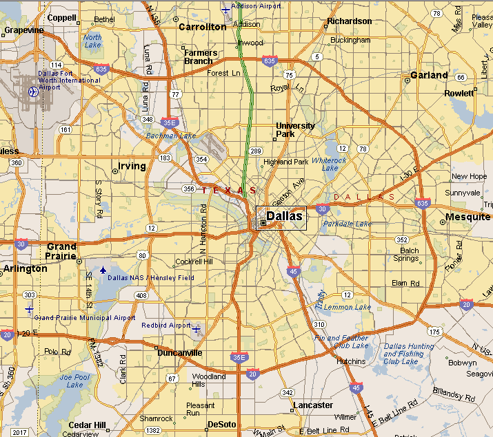
DALLAS TEXAS MAP |
|||
| PRAIRIE & LAKES | |||
|
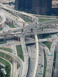
Four Interstate Highways intersect in Dallas,
Interstates 45, 20, 30 and 35E. Those Interstates serve sort of as
spokes for the loop freeways that circle around Dallas, with a small
freeway loop surrounding the downtown area. Then about 10 miles from downtown Interstate 635. Further out is the George Bush Turnpike Tollway. Then there is Loop 12. In addition to the Interstates other roads serving as spokes is the North Dallas Tollway, U.S. Highways, 67, 80, 175 and 75. At the intersection of U.S. Highway 75 (Central Expressway) and Interstate 635 (LBJ Freeway) you will find what is known as the High Five Interchange, with 5 levels of highway this is one of the largest freeway exchanges in the world. |
|
||
|
|||
|
|
|||
|
|
|||
|
|||
|
|
|||
|
Visit
our Eyes on Texas Blog to make a comment or share info about Dallas |
|||
|
|
|||
|
|
|||
| HOME TEXAS TOWNS PARADES | |||
|
|
|||
| BIG BEND COUNTRY | |||
| GULF COAST PINEY WOODS | |||
| PRAIRIE & LAKES HILL COUNTRY | |||
| SOUTH TEXAS PLAINS | |||
| PANHANDLE PLAINS | |||
|
|
|||
| Arlington Dallas Fort Worth | |||
| Grapevine Waco Glen Rose | |||
| Granbury Canton Luling | |||
 In 1996 Dallas
Area Rapid Transit (DART) became the first light rail system in the
American Southwest. DART is now has the 8th highest light rail
ridership in America. DART rapidly expanded with multiple lines, now
extending to Fair Park, the location of the State Fair of Texas. The
Green and Orange lines are being expanded to Dallas/Fort Worth
International Airport, Love Field and Las Colinas in Irving.
In 1996 Dallas
Area Rapid Transit (DART) became the first light rail system in the
American Southwest. DART is now has the 8th highest light rail
ridership in America. DART rapidly expanded with multiple lines, now
extending to Fair Park, the location of the State Fair of Texas. The
Green and Orange lines are being expanded to Dallas/Fort Worth
International Airport, Love Field and Las Colinas in Irving.